Embed Instagram Post Code Generator

( 0 Customer Review )

Laya Gasa Trek - 20 Days

US $5199/Person

Best Price

US$ 5199

Duration

20 Days

Destination

Bhutan

Season

September to November

Activity Level

Trekking and Hiking

Max Altitude

3,820 m

Highlight

A 20-day trek that traverses farmlands, alpine meadows, high passes, and remote villages along the Bhutan–Tibet border.


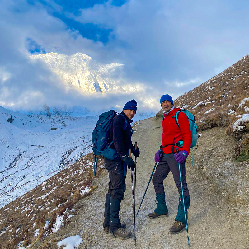
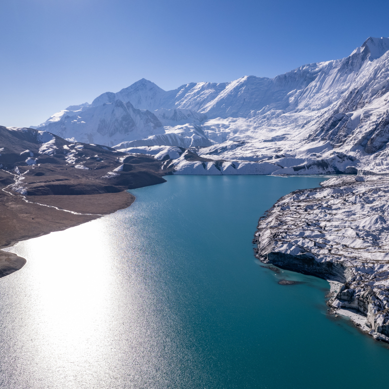
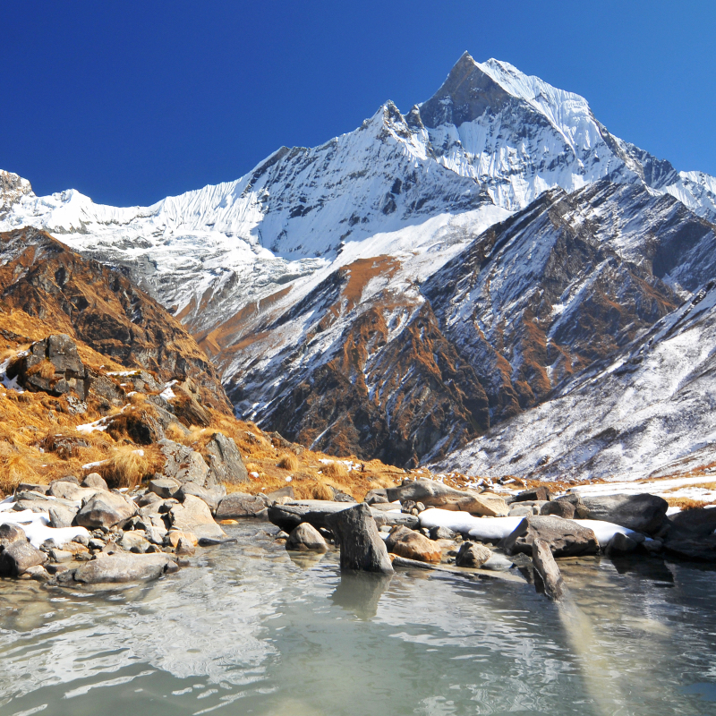
Enjoy breathtaking views of snow-capped peaks including Mt. Jomolhari, Jichu Drake, and Gangchhenta, sparkling alpine lakes, dense forests, and open pasturelands.


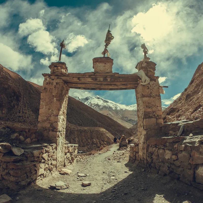
Immerse yourself in the unique traditions of the Laya people, one of Bhutan’s most remote and culturally rich communities. Explore local villages, witness traditional festivals, and experience authentic Bhutanese hospitality.


Spot rare wildlife such as blue sheep and the Takin, Bhutan’s national animal, while trekking through high-altitude pastures.


Trek begins at Drukgyal Dzong near Paro, passes through scenic villages, scattered hamlets, and farmland, and includes sightseeing in Paro, Thimphu, and Punakha.
Overview

The Laya Gasa Trek is among Bhutan’s most adventurous and culturally rich treks, offering 20 days of natural beauty, high-altitude challenges, and immersive cultural experiences. The route meanders along the Bhutan–Tibet border, allowing trekkers to explore alpine forests, sparkling lakes, remote villages, and isolated highland communities.

The trek provides opportunities to spot rare wildlife including blue sheep and the Takin, and to enjoy unique experiences such as soaking in the Gasa hot springs and spending a night at the base of the Great Tiger Mountain.Along the way, trekkers witness the magnificent snow-capped peaks of Mt. Jomolhari, Jichu Drake, and Gangchhenta, and experience the traditional lifestyle of the Laya people, one of Bhutan’s most remote and culturally vibrant communities.

Starting from Drukgyal Dzong in Paro, the trek also includes visits to Thimphu and Punakha, providing a mix of high-altitude adventure and cultural sightseeing. 

Perfect for trekkers seeking nature, culture, and adventure in one unforgettable journey, the Laya Gasa Trek stands out as one of Bhutan’s most remarkable trekking experiences, second only to the legendary Snowman Trek.

Itinerary (Plan)

Time : TBA
Max Altitude : 2200
3 star
Lunch, and Dinner

Upon arrival at the airport, you will be greeted by one of the company representatives and transferred to the hotel. After that, you will be visiting the Paro Dzong, built-in 1646 and now houses government offices and religious institutions, as do all the Dzongs (forts) currently. Cross a traditional wooden bridge along the way to the Dzong. Later on, you will be visiting Kichu Lhakhang, the oldest temple in Nepal. In the evening, ramble through the market and town of Paro. Overnight at the Hotel.

Time : TBA
Max Altitude : 900m
3 star
Breakfast ,Lunch and Dinner

Have breakfast, and make your way for a full day excursion to Taktsang or the “tiger’s nest” perched precariously on the cliff 900m above the floor of the Paro valley. Taktsang (Tiger’s Nest) Monastery, the most famous monastery in Bhutan. It is said that Guru Rimpoche has flown to the site of the monastery on the back of a tigress and meditated here for three months. Lunch would be served in the Cafeteria so enjoy it. After learning about monasteries you will be returning back to Paro in the evening. Overnight at the Hotel.

Time : 5hr
Max Altitude : 2580m
Tea House / Lodge
Lunch, and Dinner

Today, you will be driving towards Drukgyel Dzong (2,580m) from where the trek starts and camp near Sharna Zampa. With a short downhill hike on an easy broad trail. Meander alongside beautiful fields and rice terrace as we move forward the valley. Walk alongside a river named Pa Chhu then, ascend gradually on the uphill blanketed by rice paddies. Tread amid apple orchards and farmhouses, cross small settlements including Sangatan and Mitshi Zampa. A brief walkthrough blue pine forest will take us to an army post. We will need to show our trek permits and get them stamped. Cross Pa Chhu before climbing to Sharna Zampa.You will camp on the beautiful meadow below thousands of stars at Shana. Overnight at Camp.

Time : 6hrs
Max Altitude : 3110m
Tea House / Lodge
Lunch, and Dinner

Continue your adventure today you will be following the river and walking through an amazing lush forest housing oak, spruce, and pine. Witnessing the beautiful sceneries and a number of streams on our way to Singkharap will keep our eidolon high. Shingkharap is a stone house perched at an altitude of 3110m. Walk briefly then cross a small bridge on the left to reach our lunch spot. After resting for a while, again you will resume the journey. Soon you will be at the junction from where taking the right route heading to the wooden bridge. Ramble through the colourful rhododendron forest and cross the bridge to reach Soi Thangthangkha. Spend a blissful night amid lush meadows. Overnight at Camp.

Time : 5hr
Max Altitude : 4050
Tea House / Lodge
Lunch, and Dinner

Leaving behind our camp at Sio Thangthangka and making a way to ascend up to an army camp. From the camp, you will follow a river above the tree line with mesmerizing views of Himalayan peaks in the backdrop. For a few moments, rest at a yak herder camp and enjoy your lunch, then further continue our journey ahead with a walk into a valley until reaching our camping site in Jangothang at an altitude of 4050 meters. From this point, you can applaud the magnificence of Mt. Jumolhari and Jichu Himalayan peaks. Overnight at Camp.

Time : 5-6 hr
Max Altitude : 4150
Tea House / Lodge
Lunch and Dinner

Walk up toward the pass-through wide pasture land. Depending on the season you are there, you might find some yak herders in their camping tents along the way. As you come down after the pass to the Lingshi basin, you will see some beautiful views of the Lingshi Dzong and the valley and also Tserim Kang (mountain) and its descending glaciers at the north end of the valley. Camp in a stone shelter with a built-in fire pit or in a tent. Aft.- 4150 Meters, 19 Kms. Time 5-6 hrs. Overnight at Camp.

Time : 5-6 hr
Max Altitude : 4100m
Tea House / Lodge
Lunch, and Dinner

Start the trek with a pleasant walk to Lingshi Dzong nestled on the hillock. Constructed in the 17th century, the dzong is beautifully preserved. Today you will be walking on the easy trail meandering through small villages and yak pastures. On our way, you will have lunch. It will take us around 5 to 6 hours to reach Chebisa. It is a captivating small settlement embedded with cascading waterfall. Camping on the side of the soothing stream will be one heck of an experience. Overnight at Camp.

Time : 4hr
Max Altitude : 4500m
Tea House / Lodge
Lunch, and Dinner

Today’s adventure will take us all the way to Gogu La Pass at an elevation of 4500m. You will walk for around four-hour on the steep ridge to reach the pass. Admire the view of rare blue sheep then walk down the trail passing through the rhododendron forest. Have lunch then you have to follow the hills fluctuating up and down. A brief walk from here will take us to Shakepasa. A steep climb from here will take us to Shoumuthang. Take a brief rest then explore the beautiful place. Overnight at Camp.

Time : 5hr
Max Altitude : 4350
Tea House / Lodge
Lunch, and Dinner

You will walk through a wide pastureland towards Gobu-La (pass). On the way, you will see a few people herding the yaks. After crossing the Gobu -La (Alt. 4350m) descend down to the valley. The campsite is on a bench above a river, which is a tributary of the Nochu river. Get amazing sights of Gangchenta (6840m), Tserim Kang and the upper half of Jumolhari can be seen. On reaching, you will be staying overnight at Camp.

Time : 6-7hr
Max Altitude : 4140m
Tea House / Lodge
Lunch, and Dinner

After crossing the Shingela pass, aft. 4900m, you come down and follow the valley. Lemithang is under the Laya District and you will see people dressed in typical Laya costumes with conical bamboo hats. Camp at Lemithang. Aft. 4140 Meters, Distance 19 Kms. Time 6-7 hrs. If you have time, it would be advisable to spend a day here exploring the valley and meeting the people who have a unique culture and way of life. Overnight at Camp.

Time : 4hr
Max Altitude : 4100m
Tea House / Lodge
Lunch and Dinner

What can be more beautiful than observing a sparkling Gangchenta peak in front of your eye as soon as you wake up? Take some time to delve into this once-in-a-lifetime experience. After a quick breakfast, you will follow a stunning trail offering mesmerizing views. Walk past a beautiful forest with moss-covered trees while enjoying the birds chirping and singing. It is a long yet beautiful walk as we come across a beautiful waterfall and village with stone houses. Laya is an ancient village with people following traditional culture and lifestyle. It is a perfect spot to explore Bhutanese culture, arts, and tradition. Overnight at Camp.

Time : TBA
Max Altitude : TBA
Tea House / Lodge
Lunch and Dinner

The day to rest and acclimatize at Laya. Take some rest for half a day and get ready to explore the admiring Laya village. Today, you will be taking from a trail that winds up and down along the river valley avoiding natural obstacles and affording breath-taking views of the crashing river, feeder streams and waterfalls. Get to know about the locals' culture and traditions before heading back. Overnight at Camp.

Time : 4hr
Max Altitude : 4100m
Tea House / Lodge
Lunch and Dinner

The most scenic trails of today along the whole route are teamed up with soothing streams, raging rivers, and cascading waterfalls. Start walking on the trail leading to a river. A brief walk from here will take us to an army camp. The trail from here fluctuates up and down. We will have to walk past a muddy trail quite a few times, climb the ridge then descend. Ascending to Kohi Lapcha can be a bit daunting. Moving further won’t be wise, there is no better spot for camping nearby. Thus, you will spend a night here. Overnight at Camp.

Time : 3.5hr
Max Altitude : 3900m
Tea House / Lodge
Lunch, and Dinner

You will resume your trek after a delectable breakfast. First, you will climb then follow the downhill piercing fir forest leading to Babela pass at an elevation of 3900m. The pass has a few prayer flags and a stone cairn. Delve into the serene ambience, click pictures, breathe in the fresh mountain air then descend on the trail blanketed by lush forest. As it moves forward, the valley appears wide. A few up and down from here will take us to Gasa village. Spend the remaining day exploring this beautiful village. Stroll around, have a fleeting conversation with locals, experience Bhutanese hospitality then head to the hotel for dinner. Overnight at Camp.

Time : 3hr
Max Altitude : 2100m
Tea House / Lodge
Lunch and Dinner

Today you will be heading to Gasa Tsachu where you have to take a dip into the hot spring to relish your tiredness. Hot springs are believed to possess multiple medicinal benefits. Moreover, it soothes aching muscles and swollen joints. Spend the rest of the day relaxing and strolling around. Take a rest after a luscious dinner. Overnight at Camp.

Time : 2hr
Max Altitude : 2430m
Tea House / Lodge
Lunch, and Dinner

Today’s trail winds through rolling hillsides with vistas of fields, villages and Oak and Pine forests. Gasa Dzong will be visible behind, glued to the valley wall. Today’s walk goes through small settlements and finally at the camp of Geon Damji village – a large village with rice terraces on the hillsides. Overnight at Camp. 

Time : 1hr-drive
Max Altitude : 2430m
Tea House / Lodge
Lunch and Dinner

Starting at Geon Damji (2430m) and ending at vehicle point at Tashithang (1840m) From here it is 18 km (1-hour drive) to Punakha but the initial 5-6 km is unpaved. Overnight at Camp.

Time : 3hr
Max Altitude : 3840
Tea House / Lodge
Lunch, and Dinner

After a short walk to the motor road, drive down to Punakha valley. Stop at Punakha and visit the Punakha Dzong. Punakha was the former capital of Bhutan. The Dzong lies between two rivers known as Phochu and Mochu which means male river and female river. It was built by Shabdrung Ngawang Namgyal, the founder of Bhutan in 1637 A.D. and is one of the most important and historical Dzongs in Bhutan. Lunch in Punakha. After lunch, drive to Thimphu. 77 Kms. Time approx. 3 hrs. Overnight at Camp.

Time : TBA
Max Altitude : 2200m
3 star
Breakfast and Dinner

After breakfast you will visit the King’s Memorial Chorten (built-in memory of the third King of Bhutan who reigned from 1952-1972); Changangkha Monastery, traditional paper factory, Tashichodzong, the main secretariat building. This massive structure houses part of the government ministries, the office of the King and the living quarters of the Chief Abbot and monks. You will then drive to Kuenselphodrang overlooking Thimphu valley and where the giant Buddha statue is under construction. The 169 feet statue is reputed to be the largest bronze Buddha statue in the world. Later in the afternoon, you will drive to Paro. Overnight at the Hotel in Paro.

Time : TBA
Max Altitude : 2200m
3 star
Breakfast

After breakfast, transfer to the airport to catch the onward flight. Bid farewell to the remote and legendary Dragon Kingdom disappearing again behind its guardian mountains.

Live Weather

Real Tempreture
4.87 °C
Feels Like
3.13 °C
Humidity
75%
Cloud
overcast clouds

Cost Include

  • All ground transportation by private vehicle, including airport transfers
  • Assistance in acquiring Bhutan visa and visa fee
  • Accommodation at a 3-star category hotel in Paro and Thimpu, approved by Bhutanese Government
  • Full board meals (breakfast, lunch and dinner) during the trek and tours Tented accommodation during the trek
  • Govt. trained guide and necessary number of porters with their meals, salary and insurance
  • All entry/permit fees during the tour/trekking
  • All applicable government taxes and tourist service charges

Cost Exclude

  • Meals not specified in the 'Meal Inclusions' in the itinerary”
  • International flights
  • Nepal entry and re-entry visa fee
  • Pony service and porters
  • Tips for tour guide and driver

Additional Information

Physical Fitness

The Laya Gasa Trek is a moderate to strenuous high-altitude trek, requiring stamina and endurance for long daily walks across rugged trails and alpine terrain.

  • Focus on cardiovascular fitness, leg and core strength, and endurance training.
  • Consult a healthcare professional if you have pre-existing health conditions.

Altitude Considerations

  • Maximum altitude: 4,500–4,700 meters at high passes near Laya.
  • Be aware of altitude sickness symptoms: headache, nausea, dizziness, and shortness of breath.
  • Acclimatization is essential; follow your guide’s pace and rest when needed.
  • If symptoms worsen, do not ascend further; descend to a lower altitude.

Accommodations

  • Accommodation includes deluxe hotels in Paro, Thimphu, and Punakha.
  • Trekking days use tented camps or basic mountain lodges with twin-sharing arrangements.
  • Meals are provided, including options for vegetarians and special dietary needs.

Connectivity

  • Internet and mobile coverage are limited or unavailable along most of the trek.
  • Ideal for disconnecting and immersing in Bhutanese culture and nature.

Environment Considerations

  • Respect local customs, communities, and natural surroundings.
  • Follow “Leave No Trace” principles and use a refillable water bottle to minimize plastic waste.

Weather Conditions

  • Best seasons: Autumn (September–November) and Spring (March–May).
  • Daytime temperatures: 10–18°C | Nighttime: 0–5°C at high altitudes.
  • Conditions can be cold and windy at higher passes; carry layers, waterproof gear, and warm clothing.

Trekking Permits and Documents

  • Bhutan Visa: Required for all travelers. Guests can contact Mountain Tiger Nepal (MTN) to handle all visa arrangements.
  • Documents: Valid passport, two passport-sized photos, and travel insurance covering trekking and emergency evacuation.

Trek Distance, Duration, and Elevation

  • Distance: ~110 km from Paro to Laya and onward to Gasa.
  • Trip Length: 20 days including arrival, departure, and sightseeing in Paro, Thimphu, and Punakha.
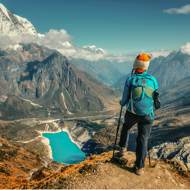
  • Elevation Gain: From 2,200 m (Paro) to 4,700 m at high passes, with gradual ascents and planned acclimatization.

Daily Trek Pattern

  • Average 5–7 hours of trekking daily, elevation gains between 300–600 meters.
  • Trek passes villages, farmland, alpine meadows, high passes, and wildlife zones.
  • Includes rest and acclimatization days to ensure safety and maximum enjoyment of Bhutanese scenery and culture.

Do You Have Any Question ? Contact Now With an Expert

 + 9779801333087

Equipments

Clothing

  • Trekking shirts (quick-dry, moisture-wicking)
  • Thermal base layers (top and bottom)
  • Fleece or wool jacket
  • Down or insulated jacket
  • Waterproof and windproof jacket & pants
  • Trekking pants and warm trousers for evenings
  • Sun hat, warm beanie, gloves
  • Moisture-wicking socks and wool socks

Footwear

  • Sturdy, broken-in trekking boots
  • Camp shoes or sandals
  • Optional gaiters for snow or mud

Trekking Equipment

  • Backpack (40–50 L) with rain cover
  • Daypack (20–25 L)
  • Sleeping bag (rated to –10°C or lower)
  • Trekking poles
  • Headlamp with spare batteries
  • Water bottles or hydration system (2 L minimum)
  • Sunglasses with UV protection
  • Toiletries, quick-dry towel
  • Camera, power bank, and memory cards

Creams and Medications

  • Sunscreen (SPF 30+)
  • Lip balm with SPF
  • Moisturizer and foot cream
  • First aid kit with painkillers, bandages, antiseptic
  • Personal medication
  • Altitude sickness medication (consult doctor before trek)
  • Water purification tablets

Miscellaneous

  • Passport, travel insurance, Bhutan visa documents
  • Notebook and pen
  • Energy bars and snacks
  • Reusable bag for waste
  • Lightweight scarf or buff for dust/cold

Route Map routemap images

Fixed Departure

# Date Cost Status Action

Freqeuntly Asked Questionnaire

The trek starts at Drukgyal Dzong in Paro and concludes at Gasa, passing through remote villages, high passes, and alpine meadows along the Bhutan–Tibet border.

It is a moderate to strenuous trek, requiring endurance for long walks at high altitudes. Trekkers should be in good physical condition and prepared for altitudes up to 4,700 meters.

Stunning views of Mt. Jomolhari, Jichu Drake, and Gangchhenta Visits to remote Laya villages and hot springs in Gasa Wildlife spotting: blue sheep and Takin (Bhutan’s national animal) A memorable night at the base of the Great Tiger Mountain

Yes. All international travelers require a Bhutan visa, which can be arranged by contacting Mountain Tiger Nepal (MTN) prior to travel.

The best trekking seasons are Autumn (September–November) and Spring (March–May) when the weather is clear, trails are safe, and mountain views are spectacular.

Reviews And Rating

How was your experience with us ?

footerartimg
Mountain Tiger Nepal Discuss about our services?
Hello, How can we help you?